recently…
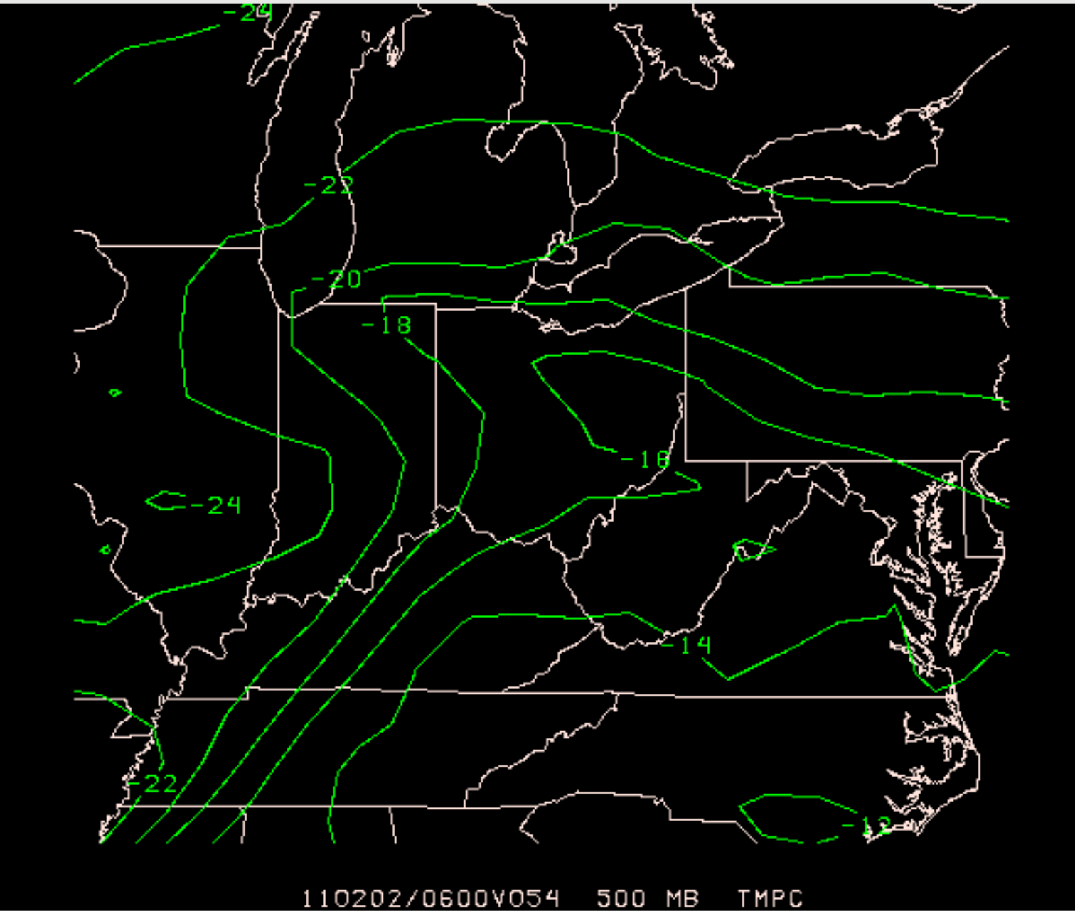
With the end goal in mind of creating customizable map graphics, I have been scouring outdated weather forums and technical software pamphlets to find a lead towards a program that fits my need. Through some trial and error, I have narrowed down my interests into a Unidata modified version of Advanced Weather Interactive Processing System (AWIPS), originally from the National Weather Service, that allows me to layer model data with a few of my notable benchmarks:
1. Access to model data without downloading to my personal computer
2. Layer meteorological parameters of my choosing
3. Control over aesthetic design, like color and map projection
I will admit that the third point is a questionable fit as this software is built for technical analysis with limited creative freedom, but it accomplishes enough for me to find/work on something more advanced in the future. Here’s a sample of a graphic that I hope to use in video formats soon:
From here, I imagine a number of styling changes will occur as I narrow down what works and what does not, but I think this a great step in the direction I want to take to produce content faster. Now I just need to forecast…
more to come
In my free time, I have been learning GIS and working with Python in the aim of combining meteorological and geographical processes for better scientific communication. I have an interest in creating weather and science videos in my spare time, but have noticed the difficulty for content creators to create matching, complex maps without advanced and expensive software. To combat this, I want to master certain GIS technology and grow my experience in Python to increase the content I can cover and create a recognizable style.
